
GeoNode 5 is out!
Dear Reader,
We are excited to announce the release of GeoNode 5, one of the most ambitious and forward-looking versions of the platform to date. This release represents a major step forward, both in terms of user experience and internal architecture. GeoNode 5 introduces deep structural improvements, powerful new capabilities, and a modernized technology stack designed to support current needs while laying the groundwork for future innovation.
From a redesigned interface to a completely re-engineered metadata system, from a more robust asynchronous engine to significant harvesting enhancements, GeoNode 5 is the result of a long-term effort to make the platform more flexible, scalable, and maintainable.
A renewed interface designed for clarity and customization
GeoNode 5 introduces a completely redesigned layout focused on usability, clarity, and visual consistency. Navigation across the platform is now more intuitive, and the overall look and feel has been streamlined to provide a modern and coherent user experience.
Beyond visual improvements, the new layout unlocks a much higher level of customization. Integrators and administrators can now easily compose custom pages and sections tailored to individual projects, without the need for invasive code changes. This flexibility allows GeoNode to adapt more naturally to different organizational contexts, workflows, and branding requirements.

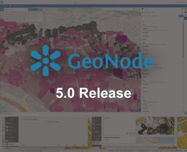
New GeoNode Homepage
A new generation metadata engine
One of the most significant evolutions in GeoNode 5 is the complete rewrite of the metadata engine and its editor. Metadata schemas and validation rules are no longer hard-coded or tied to internal models. Instead, they are now fully defined through JSON Schema, making the system cleaner, more modular, and far easier to extend. You can find all the details and further information in the documentation.
This new approach makes it straightforward to adapt existing standards, such as ISO metadata, to specific profiles. A concrete example is the Italian INSPIRE profile (RNDT), which has been entirely rewritten using the new JSON Schema–based engine. This demonstrates how GeoNode can now support complex and diverse metadata standards with much greater flexibility.
At the same time, GeoNode 5 upgrades PyCSW to version 3 Beta, paving the way for future support of the new OGC APIs currently under development. This positions GeoNode to remain fully aligned with the evolving landscape of geospatial interoperability.

New GeoNode Metadata Editor
A more robust dataset lifecycle: replace, update, validate
Managing datasets is now more powerful and reliable in GeoNode 5. The platform reintroduces the ability to replace existing datasets with newer versions, for both vector and raster data, simplifying updates while keeping the catalog clean and consistent.
For vector datasets, a new Update mode goes even further. GeoNode can now intelligently compare incoming data with existing records and decide whether to update or insert features. This comparison is based on a primary key, by default the FID field, which GeoNode automatically generates at import time. As long as the incoming dataset contains the same key, updates can be performed seamlessly.
Importantly, updates are format-agnostic: the new data does not need to match the original vector format. All update operations also support validation, ensuring that data integrity is preserved throughout the process.

Update dataset workflow
Stronger data quality through validation and constraints
Thanks to new capabilities introduced in GeoServer 2.27.3, GeoNode 5 now supports field-level constraints for vector datasets, such as numeric ranges or predefined lists of allowed values. These constraints are automatically enforced during dataset creation, updates, and replacements.
The dataset creation workflow has been rewritten to allow users to define these constraints directly at creation time. Once defined, constraints are propagated to GeoServer and consistently enforced across all interactions, including manual edits through the attribute table. Dropdowns are automatically generated for enumerated fields, while invalid numeric values are blocked.
This significantly strengthens data quality control across the entire dataset lifecycle.

Field-level constraints for vector datasets,
A more flexible and controlled permission system
GeoNode 5 introduces a new dynamic, rule-based permission system that makes access control far more flexible than before. Permissions can now be defined using almost any criterion, including contextual or temporal conditions, and can be extended through custom rules.
A new optional control also allows administrators to decide whether resource editors are allowed to modify sharing permissions. When enabled, this prevents users from making resources public or broadly accessible without approval from staff or administrators, offering tighter control over publication workflows. Detailed documentation is available for the configuration options that enable this behavior.
Richer content access and export options
To make data sharing easier, GeoNode 5 introduces two new download formats: Excel and CSV. These widely used formats simplify integration with external tools, reporting workflows, and data analysis environments.
On the client side, GeoNode now aligns much more closely with the MapStore release cycle. As a result, GeoNode 5 includes the latest MapStore improvements, ranging from enhanced mapping tools and plugins to significant advances in GeoStories and dashboards. This ensures a more consistent, feature-rich, and up-to-date client experience.
A modern asynchronous engine powered by Redis
GeoNode 5 also modernizes how background tasks are executed. Redis is now the core component for Celery’s message handling and result backend, replacing RabbitMQ and the previous database-based task tracking.
This change makes long-running processes, such as harvesting remote services, more resilient and reliable. Redis handles task state more efficiently, reducing load on the database and improving overall system stability under sustained asynchronous workloads.
From an operational standpoint, Redis also simplifies deployment and maintenance, offering a lighter and easier-to-manage alternative to a dedicated RabbitMQ broker. It is worth noting that this migration is the only breaking change requiring configuration updates when upgrading from GeoNode 4 to GeoNode 5. Detailed guidance is available in the official Migration Guidelines.
A faster and more observable harvesting system
The harvesting subsystem has received several backend improvements in GeoNode 5, making it faster, more robust, and easier to operate.
Dynamic expiration of asynchronous tasks allows harvesting jobs to adapt to workload and execution context, reducing premature failures when dealing with slow or large remote services. A new monitoring layer provides clearer visibility into each step of the harvesting pipeline, improving troubleshooting and observability.
At the same time, internal workflow optimizations reduce the number of processing steps and Celery tasks involved, increasing throughput and scalability during intensive harvesting operations.
Ecosystem updates and platform modernization
GeoNode 5 also brings important updates across the broader ecosystem:
-
The GeoNode QGIS plugin has been updated to version 2.1.0, supporting GeoNode 4 and 5 while deprecating GeoNode 3.
-
Docker images are now based on Ubuntu 24.04, addressing multiple system-level security issues.
-
Support for Python 3.12 has been added.
-
The platform has been upgraded to Django 5.
-
Legacy front-end libraries and unused components have been removed to simplify maintenance and reduce technical debt.
Last but not least a full revision of the documentation is undergoing. It’s not ready yet for publishing, but we plan to release it early next year. All contents are being reviewed, rationalized and aligned to the latest features. All with a new look and feel based on MkDocs. Stay tuned!

GeoNode documentation
Looking ahead: what comes next
The extensive refactoring in GeoNode 5 lays a strong foundation for upcoming features already under active development.
- Multilingual metadata: Future releases will introduce full multilingual support for metadata values, labels, and search, allowing titles, abstracts, and all metadata fields to adapt dynamically to the selected interface language.
- Non-spatial tabular datasets: GeoNode will support purely tabular, non-spatial datasets, enabling advanced interactions across dashboards, charts, tables, and maps, including dynamic filtering and on-the-fly joins between spatial and non-spatial data.
- Documents on the map: Documents will be placeable directly on maps using their bounding boxes, with rich media previews shown in map-click results. Images with EXIF geotags will be automatically geolocated, further blurring the line between geospatial and multimedia content.
A new chapter for GeoNode
GeoNode 5 is more than a release, it is a new foundation. With a modernized architecture, a powerful metadata framework, improved data workflows, and a cleaner operational model, GeoNode is now better equipped to grow and evolve alongside the geospatial community.
The full list of changes and bug fixes for GeoNode can be found in the changelog.
If you are interested in learning about how we can help you achieve your goals with open source products like GeoServer, Mapstore and, GeoNode make sure to talk to us!
The GeoSolutions team
