
FREE Webinar: GeoNode in Action, Delivering Real-World Impact Through Unique Land Use’s Geospatial Solutions
Dear Reader,
Join us on August 26th 2025 at 9am Eastern US / 3pm Central Europe, for the next free webinar as part of the GeoSolutions instructional webinar series on open-source software products, including GeoServer, GeoNode, and MapStore. On August 26th we will be featuring GeoNode and we’ll be joined by the team from Unique Land gmbh , a Germany-based consultancy specializing in forestry, climate, and rural development. In this session, ULU will showcase how they’re leveraging GeoNode to manage and streamline their diverse geospatial data needs across global projects—from national forest inventories to carbon certification and agricultural monitoring. You can register here below for free!
In today’s data-driven environmental projects, effective data sharing is essential. That’s why Unique land use GmbH, a leader in sustainable land management and ecosystem service valuation, relies on GeoNode to manage and distribute the data they collect, while also delivering tailored, project-ready outputs that support their consultancy work across diverse international contexts.
From assessing carbon due diligence, feasibility, performance benchmarking and monitoring in Amazonia to risk mapping in Southeast Asia, GeoNode has been integral to Unique’s ability to generate actionable insights. These insights help Unique to produce outputs such as interactive land use maps, smallholder carbon dashboards, and spatial risk planning tools. Those directly inform decision-making for both clients and stakeholders, such as governments, NGOs, the financial sector or the private sector. While their GeoNode instance is not publicly accessible, their internal workflow exemplifies a well-structured, efficient approach to geospatial data management and user managed access for key clients.

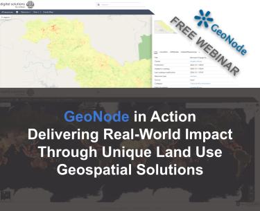
Unique Land Use GeoNode homepage.
We’re excited to share these insights in our upcoming GeoNode Webinar, where we’ll walk through how Unique uses GeoNode to support their mission. Whether you’re managing your own closed data portal or looking to optimize internal data sharing, this session is for you. You can register here below for free!
Unique’s GeoNode instance plays a key role in how they manage and present geospatial data internally. The platform allows their teams to:
- Store and prepare geospatial data collected or produced during various projects
- Organize datasets in a way that makes them easy to search and retrieve
- Ensure consistency and traceability through proper metadata and documentation
GeoNode acts as a central hub, helping Unique maintain control over data quality while enabling collaboration across distributed teams and partners. Many of Unique’s datasets are sensitive or proprietary, particularly those tied to land use planning, biodiversity studies, or forest inventories. For this reason, their GeoNode platform is kept private. However, it remains a powerful tool for producing polished, insight-rich outputs that support the delivery of their consultancy services worldwide.

Biomass change dataset hosted on GeoNode.
Join Us to Learn More In our upcoming webinar, we’ll walk you through:
- How Unique integrates GeoNode into its data workflows, with examples from our carbon ARR and risk mapping projects.
- The benefits they’ve seen in organizing and accessing project data
- Insights and lessons learned from their experience
- Q&A with GeoNode experts and the Unique team
Don’t miss this opportunity to see how GeoNode empowers secure, collaborative, and efficient data sharing, register now here below for free!
Looking forward to seeing you on the webinar!
If you are interested in learning more about how we can help you develop a WebGIS using MapStore or help you achieve your needs with MapStore, GeoServer, GeoNode and GeoNetwork through our Enterprise Support Services, Professional Training Services and Subscription Services please contact us!
The GeoSolutions team,
