

Government & Open Data – MassGIS statewide data delivery with GeoServer
MassGIS, the Commonwealth of Massachusetts’ Bureau of Geographic Information, is the official state agency for the collection, storage and dissemination of geographic data. Created in the late 1980s and now part of the Executive Office of Technology Services and Security, it coordinates GIS activity across the Commonwealth, sets the standards for statewide geographic data and runs one of the most comprehensive public GIS infrastructures in the United States. Its mission is to make reliable, authoritative and up-to-date spatial information available to agencies, municipalities, businesses and the general public.
The public face of that infrastructure is MassMapper, the interactive map of the Commonwealth, launched in 2021 to replace the long-serving OLIVER viewer. Alongside it, the MassGIS Data Hub publishes the same layers as downloads, services and APIs, and MuniMapper gives cities and towns without their own application a customised version of MassMapper. For more than twenty years, GeoServer has been the engine behind all of this.
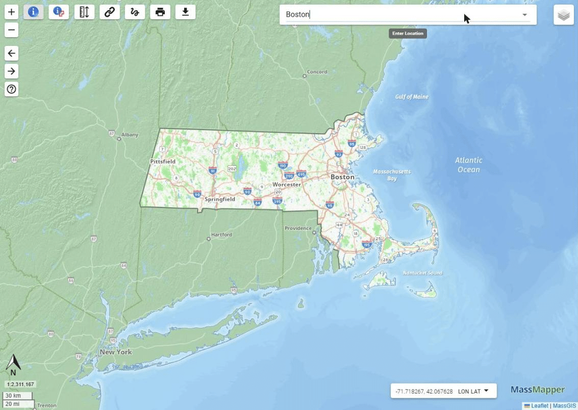
MassMapper, the interactive map of the Commonwealth. Courtesy of MassGIS.
The challenge
MassGIS serves a very diverse audience: state agencies, regional planning agencies, the 351 cities and towns of Massachusetts, surveyors, engineers, real estate professionals, researchers, developers and the public. Each of them consumes the same authoritative data in a different way, in a web browser, in desktop GIS, in a municipal application or through a script. The platform therefore had to be standards-based, so that a layer published once can be consumed anywhere, scalable enough to sustain statewide imagery and parcel data at every zoom level, and sustainable over decades, with no licence tied to the number of layers, users or requests.
The second challenge is time. A platform that has been in production since 2005 has gone through many generations of GeoServer, of Java, of the application server, of the database and of the underlying cloud infrastructure. Every upgrade has to happen without interrupting the services that municipalities and the public rely on every day.
The solution
MassGIS adopted GeoServer as the backbone of its web mapping in 2005, with version 1.5.0, and has stayed on it ever since. Today the platform runs clustered GeoServer deployments on the Commonwealth’s cloud infrastructure, with PostgreSQL and PostGIS behind them and Leaflet on the front end, combined with proprietary tools in a fully hybridised web mapping platform.
GeoServer publishes hundreds of statewide layers through OGC-compliant WMS, WFS and WCS services: parcels, addresses, structures, wetlands, land use and land cover, infrastructure, environmental and regulatory data, and the full series of statewide aerial imagery. Dynamic styling with SLD and CSS gives fine-grained control over how each layer is rendered at each scale, and the same services feed MassMapper, the Data Hub, MuniMapper and the third-party applications used by planners, assessors and emergency managers across the state. Because the services follow open standards, a municipal GIS office can load the authoritative state layers directly into ArcGIS or QGIS, with no local copy of the data to maintain.
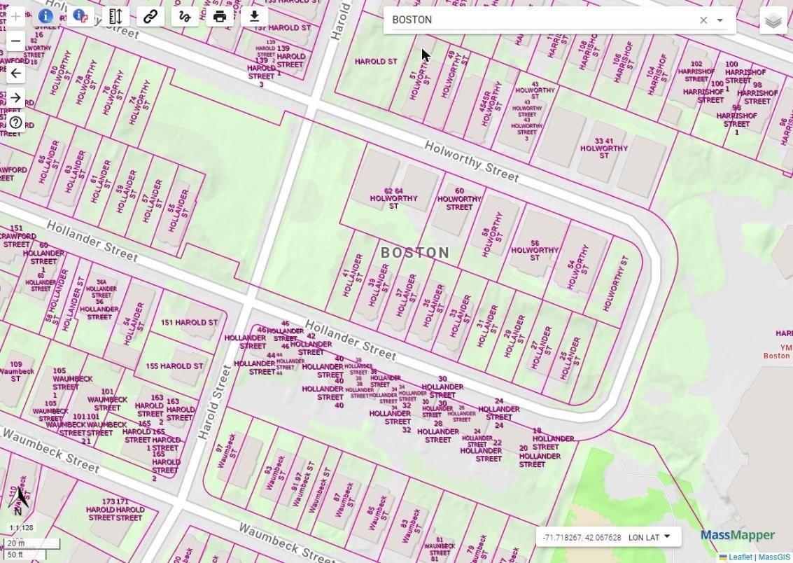
Statewide property tax parcels served by GeoServer, with dynamic labelling. Courtesy of MassGIS.
Our role
GeoSolutions has supported MassGIS for many years through a GeoServer subscription agreement. The support desk gives MassGIS a direct line to the engineers who develop GeoServer, and over the years the work has covered the full life cycle of a production platform:
- Upgrade and compatibility planning: which GeoServer release to adopt and when, and how it fits with the Java runtime, the application server and the PostgreSQL and PostGIS versions in use, so that the stack moves forward as a whole.
- Infrastructure guidance: sizing and choice of cloud instances, operating system migrations, and the evaluation of containers as the hosting model evolves.
- Database and performance tuning: configuration checks and recommendations when a database upgrade changed query performance.
- Security: proactive advisories when a vulnerability affects GeoServer or one of its libraries, with a clear assessment of the exposure and the patched versions to move to.
- Bug fixing upstream: issues found by MassGIS in the GeoServer user interface are reproduced, fixed in the GeoServer code base and released to everyone, not patched locally.
- Architectural advice and best practices, so that each change is planned once and done once.
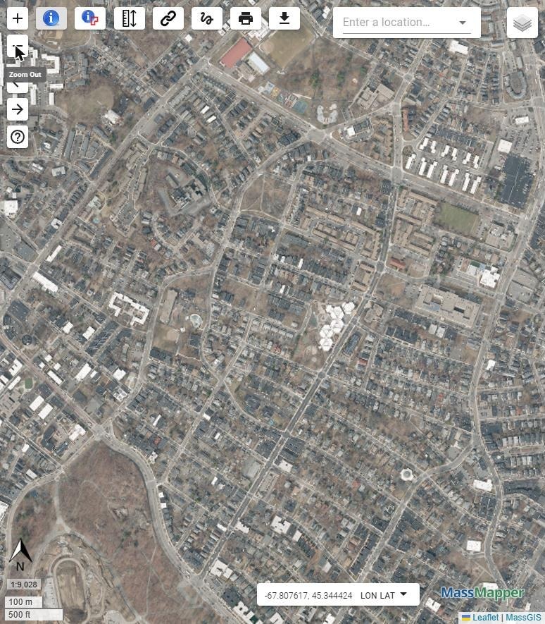
The 2025 statewide aerial imagery, published through GeoServer and available as a basemap in MassMapper. Courtesy of MassGIS.
Key results
- More than twenty years of GeoServer in production for the Commonwealth, upgrade after upgrade, with no change of platform.
- Over 250 datasets published with dynamic SLD and CSS styling.
- More than 2,500 MassMapper launches per business day.
- Over 160,000 GeoServer requests per business day, with high reliability.
- Reliable access to authoritative data and direct interoperability for regional and local GIS managers, with no duplication of hosting at the local level.
- An open-source model that cuts costs and enhances transparency statewide.
Download the case study
The two-page case study prepared together with MassGIS is available as a PDF: MassGIS Leverages GeoServer to Power MassMapper (PDF).
Last but not least, if you run statewide or municipal data services on GeoServer and want the same kind of support, have a look at our Enterprise Support Services and Subscription Services, or contact us.
The GeoSolutions Team,

See also
- Four decades of MassGIS, twenty years on GeoServer (blog post)
- MassGIS, Bureau of Geographic Information
- MassMapper
- MassGIS Data Hub
- Enterprise Support Services
