
Print Composer for MapStore and GeoNode
Print Composer for MapStore and GeoNode
Open source · Crowdfunding campaign
Print Composer for MapStore and GeoNode
Design the page, preview it live, print it. Maps, dashboards, GeoStories and multi-page atlases, rendered by a new open-source print engine built on GeoTools, the foundation of GeoServer.
From map to document · A4 portrait · 150 dpi · PDF
- Maps, dashboards, GeoStories
- Atlas mode, one page per feature
- PDF, PNG, JPEG
- Open source, released in MapStore and GeoNode
What you see on screen is not what you can print
Printing in MapStore and GeoNode still relies on an ageing integration with MapFish Print 2, built around a single map. As MapStore and GeoNode grew dashboards and GeoStories, the gap between what you can view and what you can print kept widening.
| Today | With Print Composer |
|---|---|
| The layout is fixed in server configuration, set up in advance by an administrator | You shape the page yourself, in the browser, when you print |
| A map, a legend, a scale bar and a title | Maps, text, images, legends, scale bars, north arrows, tables, charts and counters |
| Dashboards and GeoStories cannot be printed properly | Dashboards and GeoStories become multi-page documents |
| A few fixed pages at most | Multi-page documents, and atlas series with one page per feature |
What you get
Five things you will be able to do in MapStore and GeoNode. Each one is shown in the prototype we built this year.
01 · From map to document
You built the map. Now someone needs it on paper.
One click and your map is already on the page, with title, legend and scale bar in place. Pick the layout your office uses: landscape or portrait, one sheet or several. Click anything to change it and the preview updates while you watch. Choose quality and format, print, and keep working while the document is prepared in the background.
- Ready-made layouts to start from
- Live, editable preview
- Printing runs in the background
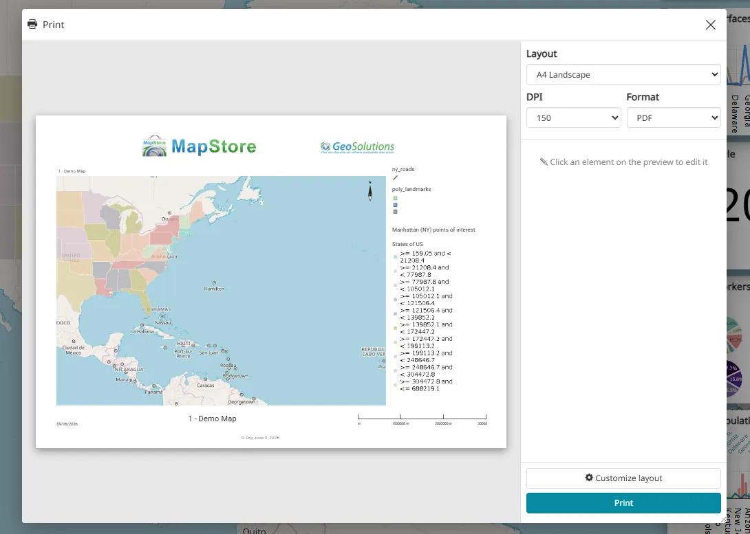
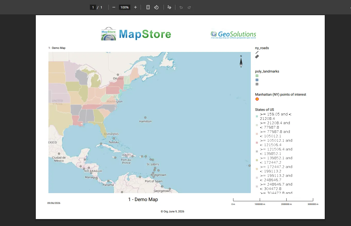
The preview in MapStore and the PDF produced by the print engine.
02 · Design your own layout
When the ready-made layouts are not enough, make your own page
Start from an empty page at its real size, on the paper and orientation you need. Add your logo, a title, the map with the layers you were already looking at, a scale bar and a north arrow. Move, resize and style every block. Your page is saved as a layout of its own, ready to use again.
- Real paper sizes
- Every element movable and stylable
- Layouts saved and reused
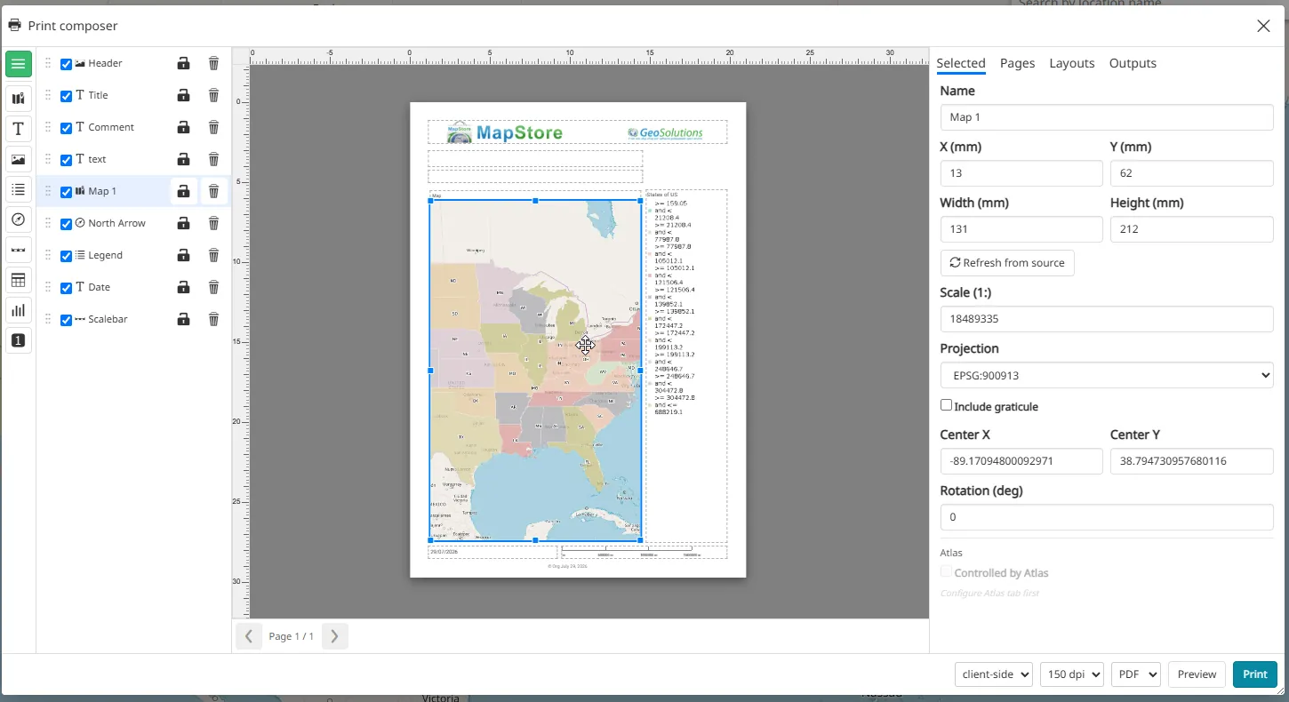
Print composer · 150 dpi · PDF
03 · Print an atlas
One layout, one page per feature
Turn on atlas mode and point it at a layer. Every feature becomes a page, named by the field you choose, and the map follows along. One page per state, region, district or site, with cover and back pages if you want them. Print it once and get one document, however many pages your territory needs.
- Driven by a WFS or GeoJSON layer
- Map follows each feature
- Cover and back pages
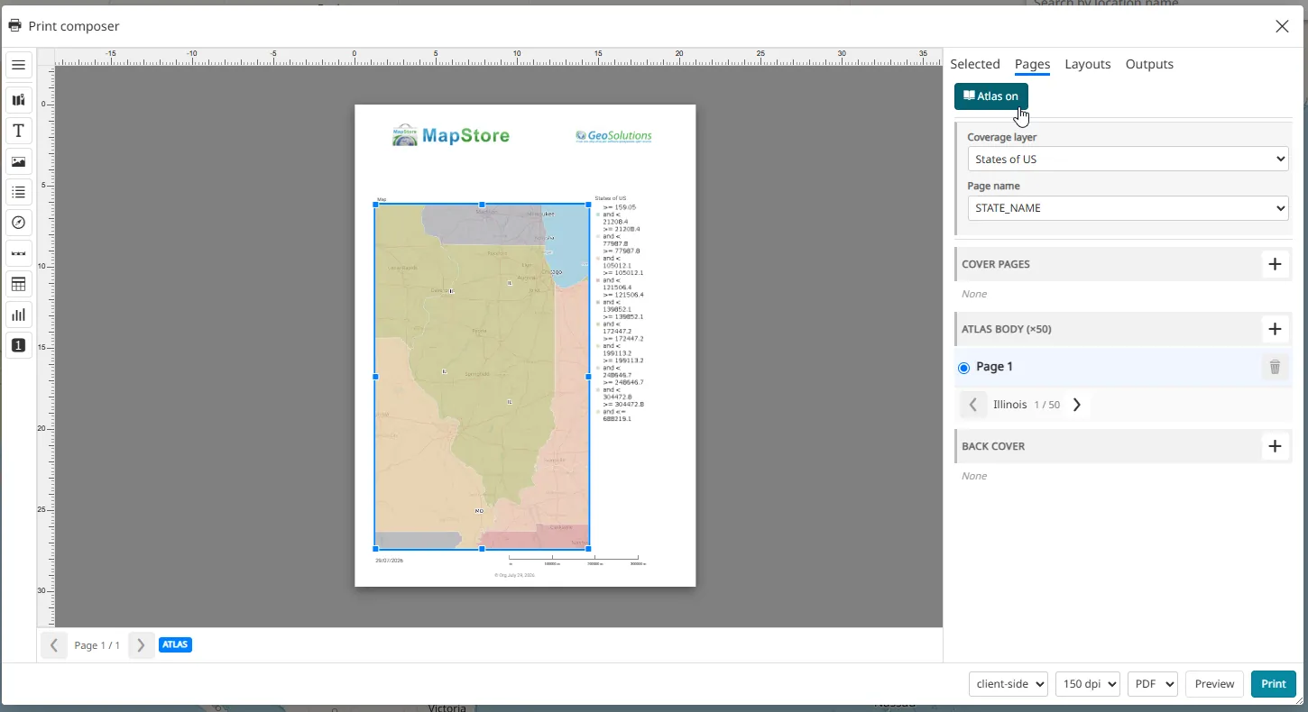
Atlas mode · 150 dpi · PDF
04 · From dashboard to document
A dashboard, turned into a report ready to send
Dashboards are built for the screen, until someone asks for them on paper. One click lays the dashboard out on the page the way you built it: the map, the table, the charts, the counters. Nothing to place by hand, and anything can still be adjusted before you print.
- Widgets become print items
- Charts, tables and counters included
- Multi-page when the content needs it
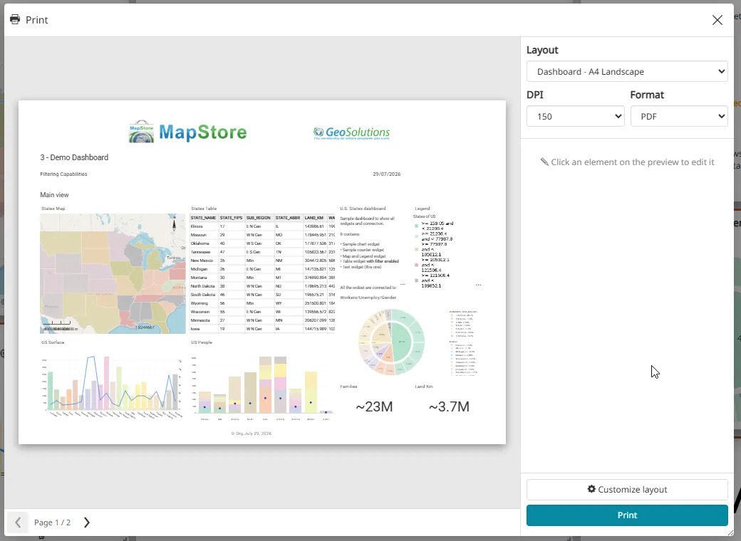
Dashboard · A4 landscape · 150 dpi · PDF
05 · From story to document
A story is made to scroll. Not everyone reads on a screen.
One click and your GeoStory is a document. Every section finds its place, in order, and content that does not fit carries on to the next page. Before you print, you can still change what each map shows. Choose layout, quality and format, and print: your story as a document you can hand out.
- Sections kept in order
- Content flows onto the next page
- Maps adjustable before printing
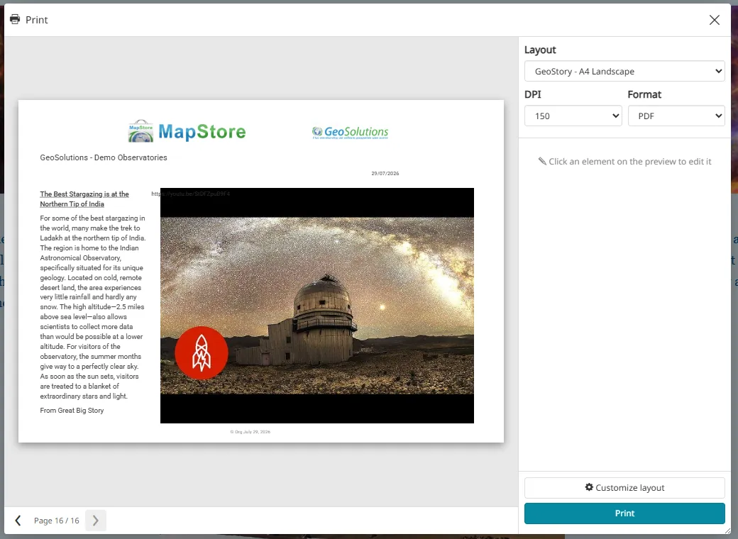
GeoStory · A4 landscape · 150 dpi · PDF
Want this in your MapStore or GeoNode? Back the crowdfunding campaign.
Everything you can put on a page
Core first release Extended second release, see the roadmap
-
Map
Core
-
Text with values filled in automatically
Core
-
Image
Core
-
Legend
Core
-
Scale bar
Core
-
North arrow
Core
-
Table from WFS or inline data
Extended
-
Chart
Extended
-
Counter
Extended
-
Overview map
Extended
Map layers
- WMS Core
- XYZ Core
- WFS Core
- GeoJSON Core
- WMTS Extended
- TMS Extended
- ArcGIS services Extended
- Georeferenced images Extended
- Graticules Extended
Filters and secured layers from the first release. Built on GeoTools, the engine can be extended to more formats, such as COG, GeoParquet and FlatGeobuf.
Output
PDF, PNG, JPEG. Every element can take its own background, border and size.
3D maps: printed as a picture of what you see on screen.
Built for production, not just for demos
Prints in the background
Large and multi-page jobs are queued. You keep working and download the document when it is ready.
Works with secured data
Layers behind authentication print too. Credentials are passed on to the data source and never written to logs.
Holds up under load
Queues, limits and timeouts keep the server healthy when many people print at once.
Fits the stack you run
A standalone Java service that runs in the same Tomcat deployments as MapStore and GeoNode, with Docker and Kubernetes supported.
Easy to operate
Health checks and Prometheus metrics for your operations team.
An open page format
Your layouts are stored in an open, versioned format, independent of the engine that renders them.
Built on GeoTools, independent of GeoServer
The print engine runs on its own and does not depend on GeoServer. It uses GeoTools, the same library GeoServer is built on, so we will look at ways to integrate the two without tying one to the other. GeoTools also makes it possible to extend the engine to more data formats, such as Cloud Optimized GeoTIFF (COG), GeoParquet and FlatGeobuf.
Not a paper design: the prototype already works
This year we built a working prototype of the composer and tested it end to end on maps, dashboards and GeoStories. We tried four rendering approaches against the same page format: MapFish Print 4, QGIS, a browser-only engine, and a new Java engine built on GeoTools and OpenPDF. We chose the new engine. It streams PDFs, handles multi-page documents and atlases, and fits the Java stack MapStore and GeoNode already use.
Want the technical details?
The full technical report, with architecture and delivery plan, is available on request. Prefer email? Write to info@geosolutionsgroup.com.
What gets built, in what order
Three releases in sequence.
First release
Core
A complete, usable printing system: the full composer; maps, text, images, legends, scale bars and north arrows; WMS, XYZ, WFS and GeoJSON layers with filters and secured access; ready-made layouts; the production print engine; GeoNode integration.
Done when a map can be designed and printed end to end on GeoNode, secured layers included.
Second release
Extended
Dashboards and GeoStories printed end to end. Tables, charts and counters; WMTS, TMS, ArcGIS, georeferenced images and graticules; overview maps; atlas authoring in the interface; undo and redo, grid, guides and snapping.
Third release
Follow-on
Layout management with a dedicated editor; time-enabled layers, including atlases with one page per time step; a light, map-only printing mode that needs no server; configurable fonts and complete documentation.
Timeline: work starts progressively as funding is committed. The full plan takes six to nine months from kickoff to release in MapStore and GeoNode.
Not in this plan: full 3D rendering (3D maps print as a picture of the screen) and import of QGIS layouts.
Who builds it
GeoSolutions. Our team includes core committers and steering committee members of GeoServer, GeoNode, MapStore and GeoNetwork, and has worked on open-source geospatial software since 2006. The composer is designed by the MapStore team, the print engine by the GeoServer and GeoTools team.
Crowdfunding campaign
Help us bring it to production
The prototype is done. Turning it into a production-grade part of MapStore and GeoNode is a bigger job. GeoSolutions is funding part of it with its own resources, and we are asking the organisations that use MapStore and GeoNode to fund the rest through this crowdfunding campaign, the same way GeoServer 3 was funded. Everything is released as open source.
Goal
€120,000
Pledges close on 31 March 2027.
-
Pledge
Tell us with the form how much you would like to contribute. Contributions start at €500, there are no fixed levels.
-
No charge now
Work starts progressively, as funding is committed.
-
Invoice later
We send the invoice when the work starts.
-
Early access
You get early access to the builds and a channel to give feedback on the design, and your organisation is listed on this page if you agree.
Already a GeoSolutions customer?
Talk to your GeoSolutions contact and we will agree your contribution privately.
Partners and resellers
You can pool contributions from your own customers. Just mention it in the form.
Pledge your contributionQuestions? info@geosolutionsgroup.com
Privacy and terms
We use what you enter in the pledge form only to manage your pledge: to contact you about it, to plan the work and, when work starts, to invoice you.
We will not add you to newsletters or send you marketing emails because of this form.
We list your organisation on this page only if you allow it in the form. You can change your mind at any time.
The form runs on Google Forms. Answers are stored in GeoSolutions’ Google Workspace and seen only by the GeoSolutions staff running the campaign.
A pledge is a statement of intent, not an order. Nothing is charged until work starts, and payment terms are agreed with you then.
To see, correct or delete your data, write to privacy@geosolutionsgroup.com. Full details in our Privacy Policy.
Contributors
Organisations that have pledged and agreed to be listed, in alphabetical order. No amounts.
- Organisation name
FAQ
Will the result be open source?
Yes. Everything is released as open source in MapStore and GeoNode.
What happens if the goal is not reached?
We look at how far the pledges get, then GeoSolutions decides whether to cover the gap. Nothing is charged until work starts.
When do pledges close?
On 31 March 2027. Work starts progressively before then, as funding is committed.
We are already a GeoSolutions customer. How do we contribute?
Talk to your GeoSolutions contact. We will agree the details with you privately.
Do we need to be a GeoSolutions customer?
No. Anyone can pledge through the form. If you are not a GeoSolutions customer, we send you an invoice when work starts.
Is there a minimum?
Contributions start at €500. There are no fixed levels.
Can we contribute code instead?
Code is welcome through the usual project channels, but it does not count toward the funding goal.
When will it be available?
Work starts progressively as funding is committed. The full plan takes six to nine months from kickoff, in three releases. The first one is a complete, usable system.
Does it need GeoServer?
No. The print engine does not depend on GeoServer. It is built on GeoTools, like GeoServer, and we will look at ways to integrate the two without tying one to the other.
Will 3D maps print?
Yes, as a picture of what you see on screen. Full 3D rendering is not part of this plan.
Can I read the technical details?
Yes. We share the technical report on request. Request the technical report or write to info@geosolutionsgroup.com.
What do you do with my data?
Only what is needed to manage your pledge. See the privacy notice below the pledge button.
Questions, or want a walkthrough?
Write to info@geosolutionsgroup.com. We are happy to go through the demo with you in a short call.