

Smart City Expo World Congress 2026: open source foundations for resilient cities

Dear Reader,
We are back from Barcelona, where Smart City Expo World Congress 2026 took place from 3 to 5 November 2026 at Fira Barcelona Gran Via. This year’s theme was “Urban Solutions, Real Impact”, and it set the tone for three intense days.
GeoSolutions was there as an exhibitor in the Italian Pavilion (Hall 2, Stand C161). We spent the event meeting clients, partners and many new organisations we had never met before. In this post we share what we heard from them, and what we think it means for the cities planning their next geospatial platform.
What we saw in Barcelona
Municipalities and companies from all over the world came to Barcelona to show what they are building. Three topics came up in almost every conversation at our stand:
Climate resilience – flood risk, heat islands and extreme weather are no longer future scenarios. Cities need to understand where they are exposed and act before the next event.
Sustainable mobility – transport networks, traffic and public space are being redesigned around data, often in real time.
City planning – urban development, housing and infrastructure decisions are increasingly tested on data before they reach the ground.
What these projects share is their foundation. Behind almost every solution there is a geospatial platform that collects data from many sources, keeps it consistent and turns it into decisions. The “smart city” label is fading. What cities want now is to be resilient, and location data is how they get there.
Digital twins: from showcase to strategy
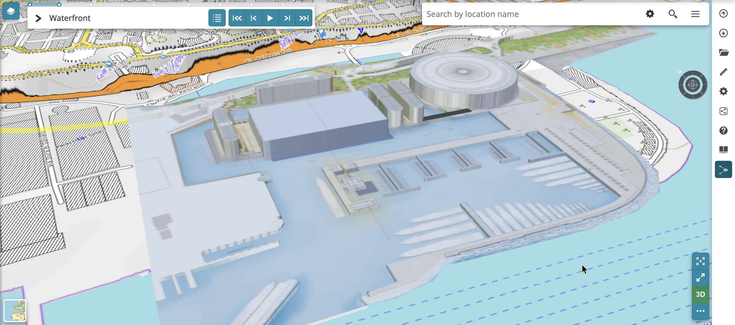
Digital twins were described again and again as the next frontier for cities. A few years ago, a digital twin was often a striking 3D model shown at events. In Barcelona, the conversation had clearly moved on.
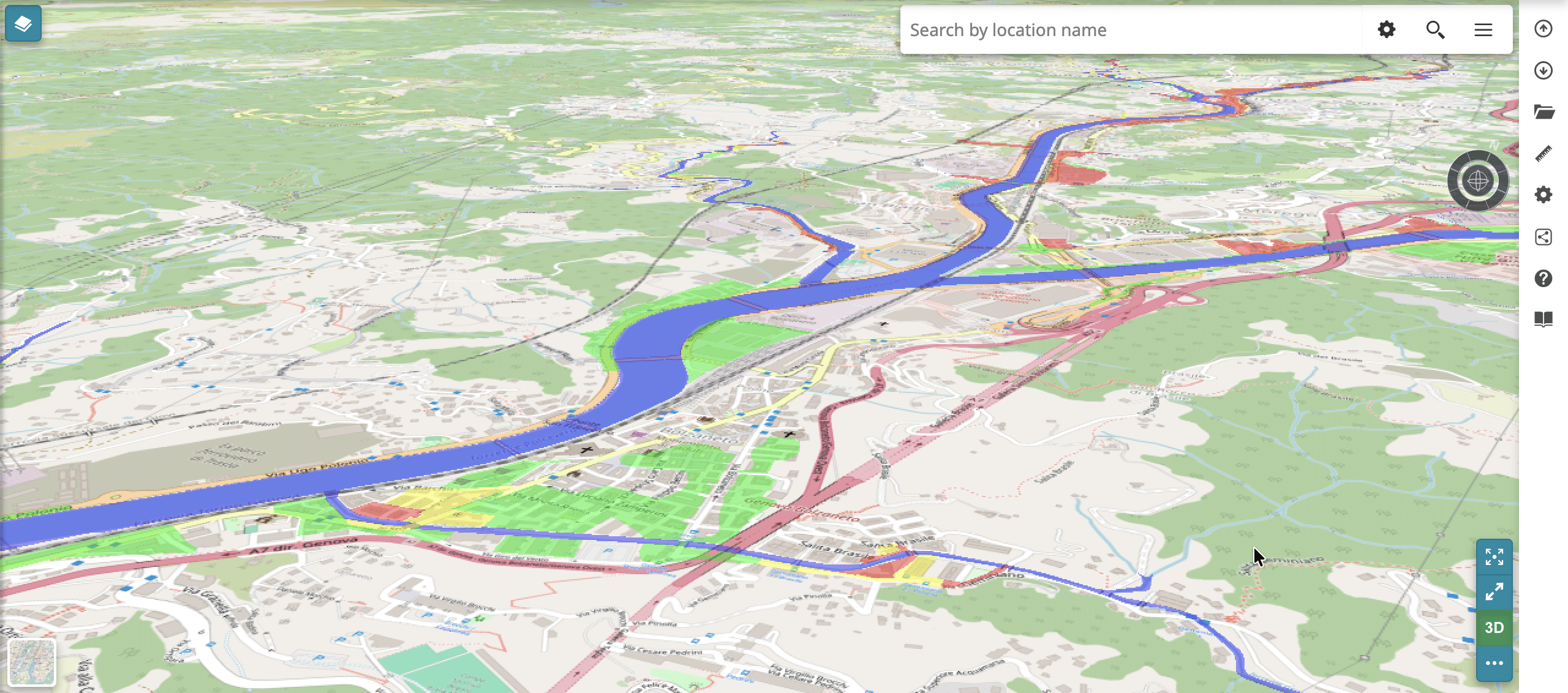
Cities still use their twins to understand their current status: buildings, networks, environment and services, all in one place. But the real value is what comes next. A digital twin is the base for models that explore different future scenarios: what happens to a neighbourhood during a flood, how a new mobility plan changes traffic, which areas suffer most in a heatwave.
With climate change, testing those scenarios before acting has become essential, not optional. It lets cities plan with evidence, compare options and explain their choices to citizens.
The open source shift is real
The most encouraging part of the event was the people we met. Many of the organisations that stopped by were new to us, and many of them had already moved away from proprietary GIS, or never adopted it. Some started directly on open source. Others run hybrid architectures, where open source components work side by side with commercial products.
In many cases, GeoServer, MapStore and GeoNode were already part of their stack, running in production. We heard this from them directly, and it is the best confirmation of the work we do every day.
Behind many of these choices there was one recurring theme: digital sovereignty. Public administrations increasingly want to decide where their data lives, who can access it and which technologies they depend on. Open source, built on open standards, lets them keep that control instead of handing it to a single vendor.
At our stand we showed concrete examples built on these three products, from geoportals that publish and share data to applications for exploring urban data in 2D and 3D. Open source isn’t the alternative anymore. For many cities, it is the standard.
Our view: why the foundation matters
A digital twin is only as good as the platform underneath it. If cities want to simulate their future, they need to own the base those simulations run on. From our experience, a city-ready geospatial platform needs four things:
Open standards. Data published through OGC standards can be reused by any tool, today and in ten years. It does not stay locked in one vendor’s format.
Control over data and costs. Open source removes per-user and per-server licences. Cities can scale their platform as their needs grow, and invest the budget in their own projects.
Room to grow. A platform built on open, modular components can add new data sources, sensors and models without starting over. Today’s geoportal becomes tomorrow’s digital twin.
Professional support. Open source in production still needs expertise. Long-term maintenance, security updates and fast answers when something breaks are what make it a safe choice for public administrations.
The cities we met in Barcelona are not choosing open source just because it is free. They choose it because it gives them independence, and that independence matters even more when the stakes are as high as climate adaptation.

See you next year, Barcelona
A big thank you to everyone who visited our stand, and to those who welcomed us at theirs. The conversations we started in Barcelona continue now, and we look forward to the next edition.
If your organisation is building a geoportal or a digital twin on open source, or is thinking about moving away from proprietary GIS, we can help you design, deploy and scale it:
- Enterprise Support Services: priority access to our experts for GeoServer, MapStore and GeoNode in production;
- Professional Training: courses for your team, from beginners to advanced users;
- Subscription Services: long-term maintenance and support for your platform.
Contact us to learn more,
the GeoSolutions team
